Ridgewood Estate Swords - Planning
The information below is from the Fingal County Council Meeting Held on the 11th of November 2013 regarding planning at Ridgewood Estate Swords.
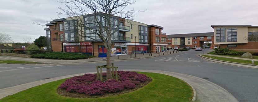
Shops at Ridgewood Estate Little Forrest Cloughran / Swords
Ridgewood Estate Swords - Planning
2. TRANSPORTION
Proposed Access and Increased Traffic levels along Ridgewood Avenue
and Cedar Park
The majority of the submissions received express serious concerns about the
proposed access to the LAP lands from Ridgewood Avenue and Cedar Park.
Many state that either Ridgewood Avenue or Cedar Park is not suitable for any
additional traffic. They say currently cars park on both sides of Ridgewood
Avenue and Cedar Park and so there is only space for one car to pass at any
one time. They say that the situation has been exacerbated by the recent
opening of the football pitches at the western end of Ridgewood Avenue. One
submission says that the circular road (Cedar Park-Cedar View) carries too much
traffic and is a danger to children going to shops and playing greens. End of
Cedar Park should be made into a cul de sac to prevent it becoming a short cut
or throughway. A second vehicular access into Cedar Park will result in
additional traffic at the junction of Cedar Park and Cedar Square and this will
increase likelihood of accidents there. This junction should be redesigned. Many
are concerned about the potential for accidents involving children crossing to local play areas. Many of the submissions call for alternative access arrangement
to be considered. Some submissions from Ridgewood Avenue suggest vehicular
access should only be from Cedar Park and pedestrian access only from
Ridgewood Avenue.
Access to Ridgewood Estate
Concern is also expressed regarding the single in/out access arrangement for
the entire Ridgewood development. One submission notes that two access
points are proposed into the LAP lands to allow for emergencies but the entire
Ridgewood Estate only has one access/exit. Several submissions call for a
second access into Ridgewood and one submission states that there should be
another entrance from Rivervalley, as originally envisaged.
Traffic Calming
Several submissions are seeking traffic calming measures to be put in place
within the existing Ridgewood development, particularly along Ridgewood
Avenue and Ridgewood Place.
Car parking
A car parking provision of 1-2 spaces per house is insufficient to cater for parking
requirements; at least 2 per dwelling should be required.
Construction Traffic
Many submissions express concerns about the potential impact of construction
traffic in terms of inadequacy of existing roads to accommodate construction
vehicles, damage to footpaths, also the noise, vibration and pollution effects
associated with construction traffic and fundamentally the danger to children.
One submission suggests construction traffic should be via the Forest Road.
Public Transport
Some submissions refer to a very limited bus service available to the residents of
Ridgewood and say that further development will increase demands for public
transport services. One submission queries the Development Plan Local
Objective 325 to provide a bus only link between Rathingle and Rivervalley and
asks where will this link run? Where will stops be located? And who will provide
the service?
Pedestrian/Cycle lanes
Many express concern about the indicative location of the pedestrian cycle lane
traversing the open space area at the northeastern corner of the LAP lands,
adjoining Cedar View and would like it redesigned to avoid crossing the proposed
and existing open space. One submission asks where the cycle lanes will be
located. Will they just be faded white lines on a footpath? Another submission
strongly objects to the proposed pedestrian walkway from the LAP lands to
Cedar View as this would provide easy access to derelict lands and is concerned about child anduction at Ridgewood.
Response:
General comment
The proposed LAP lands are, effectively, the final phase of the Ridgewood
residential development. As with any phased development, later phases have
traffic impacts on earlier, completed phases. In this case, the LAP lands will
have traffic impacts on the existing houses; however the outcomes of the Traffic
Impact Assessment undertaken for the LAP indicate that the existing roads are
within capacity and capable of accommodating the increased traffic flow.
Re: Proposed Access and Increased Traffic levels along Ridgewood
Avenue and Cedar Park
There will be an increase in traffic generated by the proposed LAP. The volume
of additional traffic was quantified in the TIA as approximately 150 cars in the
morning peak hour. The approach of the LAP is to spread the effect of the
additional traffic thereby minimizing its impact on residential amenity. The
alternatives are as follows.
1. Build a completely new access road to the south of Rathingle, which
would be outside the scope of this LAP.
2. Allow only one access to the LAP lands, thereby concentrating the traffic
impact on one access road. In general, the observers from Cedar Park
propose that the single access should be Ridgewood Avenue, whereas
the observers from Ridgewood Avenue propose that the single access
should be Cedar Park.
Therefore, no change to the proposed access arrangements is recommended.
However, additional traffic calming should be provided along Ridgewood Avenue
and Cedar Park.
Re: Access to Ridgewood Estate
The Council normally seeks to have two accesses into any development of more
than 100 houses, to avoid the disruption that would occur should a single access
be closed (e.g. for a fire or a fatal accident investigation). Ridgewood currently
has over 1000 houses and an additional access would be desirable but it is not
available. The only possible option of a second access to Rivervalley has been
discussed by the Council during the course of the 2002 LAP for Ridgewood
(Rathingle) and was roundly rejected at that time. It would not be appropriate to
reconsider this matter. The entire Ridgewood Housing Scheme has been traffic
assessed on a stand alone basis.
Re: Traffic Calming
This matter was discussed by the Council, but not proceeded with due to lack of
funds. However, it is recommended that additional traffic calming measures are put in place at Ridgewood estate, prior to the occupation of any houses.
Re: Car parking
The residential parking standards in the County Development Plan are now
norms (as opposed to maximums) and require 2 car parking spaces within the
curtilage for houses with three+ bedrooms, and allows 1- 2 car parking spaces
within the curtilage for houses with up to two bedrooms. A mix of 2, 3 and 4 bed
roomed houses is proposed in this LAP. Given the concerns expressed by
existing residents regarding the insufficient parking provision in Ridgewood, it is
recommended that all houses within the LAP lands have two car parking spaces
within the curtilage.
Re: Construction Traffic
Construction traffic for the LAP lands will have an impact on the existing
residential development. It is possible to put conditions on planning permissions
requiring a Construction Management Plan. Such a Plan would have restrictions
on the times of access and egress of construction traffic – e.g. restricting
construction traffic from accessing/egressing the site around school opening and
closing times. It is recommended that an additional objective be inserted in the
LAP, “TM 6”, requiring all planning applications to submit a Construction Traffic
Management Plan. Any such plan shall include a restriction on construction traffic
from accessing/egressing the site around school opening and closing times.
Re: Public Transport
The provision of public transport services is a matter for the National Transport
Authority and public transport operators. This includes routes, and the location of
bus stops. The development of the LAP lands will lead to an increase in the
demand for public transport in the area. It is likely that the NTA and public
transport operators will respond to such an increase by increasing the number of
services on the relevant routes, thereby improving public transport for everyone
in the Ridgewood/Rathingle area.
The provision of a bus only link to River Valley is a Local Objective of the Fingal
Development Plan 2011-2017 (LO325). It would open up the possibility of
providing a viable bus route through Rathingle, which would be major
improvement. However, this proposal is not within the scope of the LAP.
Re: Pedestrian/Cycle routes
The exact location of the tie-in of the cycle route to Cedar View should be
designed to avoid traversing the proposed area of open space and not interfere
with the existing open space. The development proposed within the LAP lands
will be a low speed environment, segregated cycle lanes are not necessary.
It is recommended that the LAP map be amended to indicate that the location of
the cycle route connecting to Cedar View does not traverse the proposed nor existing open space in the vicinity of Cedar Place.
Recommendation:
1. It is recommended that an additional objective be inserted at Section 6:
“Movement and Transportation”
“TM 6 Additional traffic calming shall be provided within the Ridgewood
development and particularly along Ridgewood Avenue, Ridgewood Place
and Cedar Park, prior to the occupation of any houses within the LAP lands.”
Also,
It is recommended that the following sentence;” It is recommended that additional
traffic calming measures are put in place in Ridgewood, prior to the occupation of
any houses within the LAP lands”
be inserted at the end of paragraph 6.6 “Access to LAP Lands”
2. It is recommended that section 6.7 of the draft LAP be amended as follows:
Delete the following:
“
House-urban/suburban up to 2 bedrooms – 1-2 spaces within the curtilage
House-urban/suburban up to 3 bedrooms or more – 2 spaces within the
curtilage”
And replace with:
“In this regard all houses shall have two car parking spaces within the curtilage.”
3. It is recommended that an additional objective “TM 7” be inserted at Section 6:
“Movement and Transportation”
“Objective TM 7 All planning applications shall be accompanied by a
Construction Traffic Management Plan. Any such plan shall include a
restriction on construction traffic from accessing/egressing the site around
school opening and closing times.”
4. It is recommended that the LAP map be amended to indicate that the location
of the cycle route connecting to Cedar View does not traverse the proposed nor existing space at Cedar View.
Playground
Several submissions object to the proposed playground located on the open
space at the north eastern corner of the LAP lands. Many say that there are
already two playgrounds located along the northern boundary of the Ridgewood
development, and a third is not necessary. Some suggest that if one is required,
it should be located on the southern/western side of the LAP lands. One
submission requests that Objective GI 5 requiring a children’s playground be
omitted from the LAP and state that this requirement should be decided at
planning application stage and not prescribed in the LAP.
Protection of Trees & Hedgerows & Boundary Treatment
Many submission express concern regarding the retention and protection of
existing trees and hedgerows along the eastern boundary of the LAP lands and
some request that the existing green fence there be retained as an additional
protection measure. Some residents are concerned about the proximity of new
houses to existing hedgerows and their homes and requests that they be
positioned further away from the hedgerow and that additional trees are planted
to protect privacy. Some submissions want to know what the boundary treatment
is proposed along the existing boundary with the LAP lands.
Public Open Space
One submission from MKN Property Group (the develop of Ridgewood) requests
that the landscaped areas adjacent to the boundary hedgerows should not be
discounted as Class 2 pubic open space and request that the last sentence of
section 5.3
“"Although essential for the protection of the existing hedgerows and provide
attractive visual amenity these areas are not calculated as Class 2 open space
as they are not of recreational value.” be omitted from the LAP.
Increase in landscape buffer
Some submissions requests that the “greenbelt” between Cedar Park and the
new development be maintained and significantly increased beyond the 3m
proposed, this would further protect trees and increase amenity value to existing and future residents.
Access to Ward River Valley
One submission wants to know where access to the Ward River Valley will be
located and will this impact on traffic.
Construction Impacts
Several submissions express concerns about the noise, pollution and disruption
arising during the construction period and requests that working hours-time limits
be confined to stipulated times for the period of construction.
RESPONSE:
Re: Playground
Objective OS26 of the Fingal Development Plan requires the provision of
“appropriately scaled” children’s playground in all residential schemes in excess
of 50 units. The proposed location of the playground on the draft LAP map is
indicative only. In light of the objections raised to the proposed location, it is
recommended that the indicative playground be relocated to the South Western corner of the LAP lands. The exact location will be determined at planning
application stage.
Re: Protection of Trees & Hedgerows & Boundary Treatment
It is an objective of the LAP (GI 4) to protect the trees and hedgerows along all
the boundaries of the LAP lands. The boundary treatment with the existing
development will be formed by the retention of these trees/hedgerows... The
existing green fence along the eastern boundary could be retained, save where
necessary to be removed to allow vehicular and pedestrian access into the LAP
lands, with additional tree planting. It is recommended that an objective to this
effect is indicated on the LAP map. The proposed dwellings along the eastern
side of the LAP lands would be c. 33 metres from the westerly facing houses at
Cedar Park. For comparison purposes, the separation distance between houses
along both sides of Cedar Park are c.27 metres and along Ridgewood Close, the
distance is c.30 metres.
Re: Public Open Space
The linear green buffer zones (c.3m wide) along the eastern, northern and
western boundaries of the LAP lands are proposed as green corridors in
accordance with Objective OS 23 of the Fingal Development Plan, to protect tree
and hedgerow boundaries, to encourage biodiversity and to maintain linkages to
the amenity lands beyond, at Ward River Valley Park. The Fingal Development
Plan states that green corridors do not form part of the public open space
provision.
Re: Increase in Landscape Buffer
The function of the landscape buffer zones proposed along the eastern, northern
and western boundaries are to act as green corridors to protect tree and
hedgerow boundaries, to encourage biodiversity and to maintain linkages to the
amenity lands beyond, at Ward River Valley Park. These buffer zones are
proposed to be a minimum of 3 m in width; this is considered to be a reasonable
area of protection and generally accords with similar green corridors within
Ridgewood. The precise area given to these green corridors will be determined
at planning application stage.
Re: Access to Ward River Valley
Potential pedestrian access routes to a north/south green route to Ward River
Valley Park are indicated at 4No.locations on the LAP map: 2No. are indicated
along the northern boundary and 2No. are indicated along the western boundary
of the plan lands. This is to meet Local objective 336 of the Fingal Development
Plan. It is likely that only one or two access points will be developed. These are
proposed as pedestrian access points only, for local residents.
Re: Construction Impacts
Objective CWM 4 in the draft LAP states, ”Developers shall take adequate measures to minimize the impacts of traffic noise and dust during construction phases.” Hours of operation will be dealt with by way of a condition attached to a
grant of planning permission.
RECOMMENDATION:
It is recommended that the following amendments are made to the LAP map:
1. It is recommended that the “indicative playground” on the LAP map be
relocated to the south western corner of the LAP lands.
2. It is recommended that the LAP map legend includes an additional objective
as follows: “To retain the existing green fence, augment with additional tree
planting, along the eastern boundary, save where necessary to be removed to
allow vehicular and pedestrian access into the LAP lands.”
4. URBAN DESIGN
Residential Density
One submission wants to know the current density of housing at Cedar
Park/Cedar view viz a viz that proposed in the LAP.
Building Heights and House Type
Several submissions raise concerns about the proposal to allow 2.5 storey
dwellings, saying that there are no such dwellings in the existing Ridgewood
Development and that new dwellings should be confined to 2 storeys to avoid
overlooking, overshadowing and visual intrusion. Another contends that it is
contradictory to seek to maintain views towards Lambay and propose 2.5 storey
dwelling units. One submission erroneously expresses serious concern that the
draft LAP is proposing 2, 3 and 4 storey dwellings. There is a strong preference
for houses over apartments.
LAP Map –Layout
Concern is expressed in the submission from MKN Property Group (developer of
Ridgewood)that the proposed layout (which seeks to retain long distance views
to the north county and coast) will not achieve the densities of 30-33 per ha. and
target units numbers of 170-190 proposed in the draft LAP. The developers
contend that the proposed layout with resultant triangular plots cannot meet
Development Plan Standards and does not reflect the existing pattern of
development in Ridgewood. The submission seeks instead to have their submitted masterplan layout adopted as the LAP.
Re: Residential Density
The residential densities proposed in the LAP are similar to those pertaining in
the existing Ridgewood development. The LAP proposes a density range
between 30-33 units per hectare. The existing residential densities at Cedar Park
and Cedar View are in the range 31-36 per hectare.
Re: Building Heights and House Type
The draft LAP proposes a mix of housing units to meet the diverse needs of
future residents. 2, 3 and 4 bed roomed dwellings are proposed. No apartments
are proposed in this LAP. Two to two and half storey dwellings are proposed to
allow for architectural variety in the design of the new residential development
and also to provide some larger dwellings that can adapt to the needs of growing
families. A mix of house type and size and gives the possibility to trade- up or
down within the existing community.
Re: LAP Map –Layout
In order for the Local Area Plan and in turn the Masterplan and scheme design to
be successful, several elements have been examined and analysed in detail by
the Planning Authority.
Primary of these is context – this has been carefully described in the LAP written
document. Context then leads onto elements of the place itself that are desirable
to strive for in any further development.
i.e. Character – it should be a place with its own identity
Quality of the public realm – what its own contribution is and what
improvement it makes to the existing
Legibility – the place has a clear image
Ridgewood is a large scheme laid out to a particular model which is relatively
successful, but it does not achieve all that the Planning Authority is now required
to consider as set out in the Best Practice Urban Design Manual (DOECLG
2009).
The Rathingle LAP phase of the Ridgewood development presents opportunities
that did not exist or were not exploited in earlier phases. The topography and
location of the site will allow for character, public realm and legibility to be better
defined than has been possible up to now. To help achieve these defining
elements, the LAP proposes to integrate the important views from the area
towards the north, east and out over the coast, the value of which are recognised
in the Swords Historic landscape Character Study. The LAP also takes into
account the new well defined urban design principles incorporated into the 2011
– 17 Development Plan.
The approach by the Planning authority in the LAP map is not radical and will
provide ample opportunity for a satisfactory scheme design. The potential blocks
and streets and their unorthogonal layout provide great architectural
opportunities to provide the sense of place that could have been better achieved
in earlier phases.
The LAP recognises that to achieve the desired elements, will require specific
architectural design solutions at particular points in the development. Innovative
and site specific design are capable of providing the required densities and at the
same time cultivate a distinct character - a development with its own sense of
place, as required by the Planning Authority in this LAP.
Recommendation: No change.
5. EDUCATION-Schools provision
A number of submissions are concerned about the capacity of local schools to
cater for existing residents, aside from the pressure of further residential
development in the area.
The submission from MKN Property Group requests that in light of the statement
in the Draft LAP at Section 8.2.2. “with respect to primary and secondary school
provision, capacity exists within existing schools to cater for existing and future
needs of the LAP area”, that Objective C1 in the draft LAP, “To facilitate the
Department of Education and Skills in ensuring adequate provision of
educational facilities to serve the needs of the new community within the plan
lands”, be omitted from the LAP. They are concerned that this objective might be
interpreted to mean the provision of a school “within the plan lands”.
Response:
As part of the preparation of the Draft LAP, the issue of schools provision was
carefully considered and is detailed in Section 8 of the draft LAP. The LAP
proposes circa 170-190 new dwelling units. This equates to c. 550 additional
population. The schools provision needs arising from this is estimated to be circa
70 children, based upon guidance from the “The Provision of Schools and the
Planning System” guidelines produced jointly by the DoECLG and the
Department of Education and Science in 2008.
Information sourced from local primary and secondary schools indicated that
there is currently or will be (by reference to impending extensions to existing
schools) sufficient capacity to cater for the schools need of the new residential
community. Also, two alternative schools site have been reserved within the
Fosterstown LAP lands for a 16 classroom primary school and an extension to
St. Finian’s Community College is anticipated to go to construction in 2014/14
giving an overall capacity there of 1,000 students.
In the interests of clarity, it is recommended that the wording of Objective C1 be
amended to delete reference to “within the plan lands” as this is not the intention
of the Objective. Rather it is intended to facilitate the Department of Education to
ensure adequate provision of school facilities within the locality, to serve the
needs of the new community in the plan lands.
It is also recommended that the word “existing” be deleted from last sentence in
section 8.2.2 as follows
“With respect to primary and secondary school provision, capacity exists within
existing schools to cater for existing and future needs of the LAP area.” be
amended to read;
Page 118“With respect to primary and secondary school provision, capacity exists within existing schools to cater for future needs.
Recommendation:
1. It is recommended that Objective C1-
“To facilitate the Department of Education and Skills in ensuring adequate
provision of educational facilities to serve the needs of the new community within
the plan lands.”
be deleted and replaced by the following:
“C1 To facilitate the Department of Education and Skills in ensuring adequate
provision of educational facilities within the locality, to serve the needs of the new
community.”
2. It is recommended that the last sentence in section 8.2.2
“With respect to primary and secondary school provision, capacity exists within
existing schools to cater for existing and future needs of the LAP area.”
be amended to read;
“With respect to primary and secondary school provision, capacity exists
within existing schools to cater for the future needs of the LAP lands.”
6. INFRASTRUCTURE
Foul Drainage
The submission from MKN Property Group acknowledges that the Swords Waste
Water Treatment Plant is being upgraded and that no dwellings shall be occupied
within the plan lands, until the upgraded WWTP is commissioned. However, they
are concerned about the further restriction on development in the draft LAP
regarding network constraints identified at North Street and Forest Road in the
Greater Dublin Strategic Drainage Study. These constraints, they state, are
outside their control and so they have requested that Objective FD1 which states
”Housing occupation can only take place following commissioning of the Swords
WWTP upgrade works and the network constraints have been remedied”, be
revised to omit any reference to the need for network constraints to be remedied.
Response:
The network in Swords has been modelled and the constraints have been
identified in the GDSDS. The proposed development at Rathingle would have
been included as part of the 2011 scenario, which required the upgrade works.
All of the upgrading in Swords is not required to facilitate this development. The
exact extent and locations of the upgrading can be agreed in advance of any development within the plan lands.
Summary of Proposed Amendments to LAP map:
1. It is recommended that the “indicative playground” on the LAP map be
relocated to the south western corner of the LAP lands.
2. It is recommended that the LAP map legend includes an objective as follows:
“to retain the existing green fence and augment with additional tree planting,
along the eastern boundary, save where necessary to be removed to allow
vehicular and pedestrian access into the LAP lands.”
3. It is recommended that the LAP map be amended to indicate that the location
of the cycle route connecting to Cedar View does not traverse the proposed nor existing open space in the vicinity of Cedar View Ridgewood.